NASA’s Curiosity Looks for New Indications Regarding the Ancient Water on Mars
NASA’s Curiosity rover has started investigating a new area of Mars that may have information on the exact moment when liquid water vanished from the surface of the Red Planet. Mars was likely warmer and significantly wetter billions of years ago than it is now. As it travels beside and finally crosses the Gediz Vallis channel, an intricate, snake-like structure that, at least from space, looks to have been sculpted by an ancient river, Curiosity is receiving a fresh perspective on that more Earthly past.
Scientists are intrigued by that prospect. In order to verify how the passage was chiseled into the underlying bedrock, the rover team is looking for proof. The team believes the waterway was not created by wind because of how steep the walls of the structure are. Nevertheless, a river carrying rocks and sediment or debris flows (quick, wet landslides) would have had sufficient force to carve into the bedrock. The waterway was filled with rocks and other debris after it had created. Researchers are also interested in finding out if dry avalanches or debris flows carried this material.
Curiosity has been climbing the slopes of Mount Sharp, which is located 3 miles (5 km) above Gale Crater floor, since 2014. Scientists may examine how the presence of water and the chemical components needed for life evolved over millions of years in the lower regions of the mountain due to the shifting Martian climate.
For instance, when a lot of water had interacted with rock, a layer rich in clay minerals was present in the lower portion of those slopes. The rover is currently investigating a stratum rich in sulfates, which are salty minerals that frequently develop when water evaporates.
Updates to Mount Sharp’s Schedule
A thorough investigation of the waterway will take months, and the information gathered may cause scientists to recalculate the mountain’s development timeframe.
After wind and water deposited the sedimentary layers of lower Mount Sharp, erosion eroded those layers away to reveal the layers that are visible today. The Gediz Vallis channel could not have been carved until after these protracted processes and extremely dry spells that left Mount Sharp’s surface as a sandy desert.
Since Curiosity will never reach the top of the mountain, scientists believe that the rocks and other debris that later filled the channel originated there. This gives the crew an idea of the potential materials that may be present at that elevation.
“If the channel or the debris pile were formed by liquid water, that’s really interesting. It would mean that fairly late in the story of Mount Sharp – after a long dry period – water came back, and in a big way,” said Curiosity’s project scientist, Ashwin Vasavada of NASA’s Jet Propulsion Laboratory in Southern California.
That interpretation would be consistent with one of the most unexpected findings of Curiosity’s ascent of Mount Sharp: instead of progressively evaporating as the planet grew drier, water appears to have come and gone in phases. Mud fissures, shallow saltwater lakes, and, right under the channel, massive debris flows that accumulated to form the expansive Gediz Vallis ridge are all examples of these cycles.
Curiosity undertook a strenuous climb last year in order to investigate the ridge, which appears to grow out of the channel’s terminus and spans the slopes of Mount Sharp, indicating that both are a component of the same geologic system.
Examining the Channel Up Close
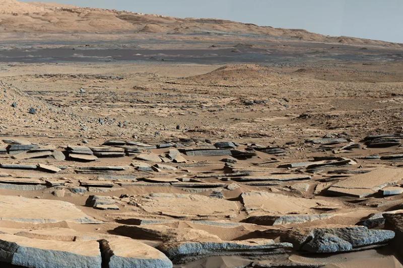
Curiosity used the left navigation camera on the rover to capture a 360-degree black-and-white panorama of the channel. The image, which was taken on February 3rd, the 4,086th Martian day, or sol, of the mission, depicts a debris pile building slightly behind the sand and dark sand filling one side of the canal. The steep hill that Curiosity ascended to get here is to the other side.
At the conclusion of every drive, the rover uses its navigation cameras to capture these kind of panoramas. Presently, as engineers work to find a solution that limits the usage of one imager from the color Mast Camera, or Mastcam, the science team is depending even more on the navcams.
Additional Information About the Mission
Caltech oversees JPL, which is located in Pasadena, California, and built Curiosity. On behalf of NASA’s Science Mission Directorate in Washington, JPL is in charge of the project.